Argus ONE Import/Export Capabilities
Connectivity with other Software Packages
Argus ONE allows you to import information from many sources and export information in any format. This page lists the predefined import and export formats. To read about Argus ONE unique capabilities to export information in any format click here.
Supported Import Foramts
You can import a wide range of information types and formats into the Argus ONE workplace. The different data sources can be categorized into 4 main types:
- DXF and Contours - Import information related to graphic objects such as points, lines, polylines, arcs, etc.
- GIS Shape files - Import shapes and the information related to them using Arc/Info ArcView Shape files
- Data at X, Y locations - Import information listed at X, Y locations.
- Meshes - Import meshes created outside of Argus ONE. (Only with Argus MeshMaker Triangular and Quadrilateral mesh modules)
- Images
You can use the various Argus ONE Import file formats to import:
- DXF files of:
- Background maps
- Information and domain outline contours
- Arc/Info ArcView Shape files of:
- Background vector maps
- Information, coverages and domain outline contours
- Data layers
- Text (ASCII) files of:
- Information/domain outline contours
- Scattered data points - using Argus ONE generic formats
- Scattered data points from tables - using the Spreadsheet PIE
- Finite triangular elements mesh
- Finite quadrilateral elements mesh
- Data points on triangular mesh
- Data points on quadrilateral mesh
- Data points on a block centered rectangular grid
- Data points on a grid centered rectangular grid
- Images
- GIF
- TIFF
- XBitmap
- MacPaint
- Windows DIB
- Sun Raster
- Nexpert Objects Images
DXF, Shape and contours files enable you to import contoured information describing the distribution of physical parameters. Point wise data enable you to import information sampled from surveys and from observation points such as wells and measurements stations, as well as to import model results lying on meshes and grids.
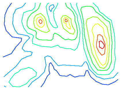
The following screen shot presents contours imported into an Argus ONE information or maps layer from a DXF file or from an ascii file in Argus ONE contour file format.

The following screen shot presents scattered or meshed information imported into an Argus ONE data layer from a ASCII file.

The following screen shot presents graphic objects imported into an Argus ONE information or maps layer from a DXF, or a ArcView (ESRI) Shape files, or an Argus ONE contour file. Using DXF and ASCII contour files you can import and create complex background maps as well as the spatial distribution of natural or man-made phenomena.

The following screen shot presents a graphic objects placed into an Argus ONE maps layer from a TIFF file. Using Images can be used for orientation purposes and for digitizing information to transform it from Raster data to vector data.

Predefined Export Formats
Argus ONE supports several predefined export formats:
- Argus ONE generic vector formats
These formats are unique since the data may describe both the graphic objects (shapes) and the data associated with them or just the shapes. It's available from the follwing layer types:
- Information layers - Argus ONE contours (polygons, polylines) - also supported through copy/paste
- Data layers - Argus ONE scattered structured data points
- Maps layers - Argus ONE CAD like shapes - also supported through copy/paste
- Spreadsheet-like format
- Export any data associated with spatial objects in tabulated (spreadsheet-like) format
using the copy from the Show Values Floaters
- DXF
- ArcView, Arc/Info Shape files - See Shapefile IO PIE
To next page of introduction
|


